THE GEOGRAPHICAL SETTING |
* the geographical setting, natural features and resources of ancient Sparta
* significant sites: Sparta |
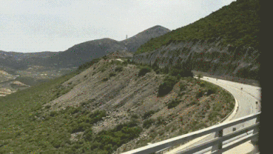
A tourist films exiting the valley - youtube
|
• Sparta was situated 200m above sea level at the northern end of the alluvial plain of Lakonia.
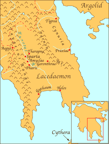
• To the west of Sparta lay the Taygetus mountain range. • The Eurotas River provided much needed water, while the small Lakonian plain, enabled the Spartans to grow food. • The lower slopes of the mountains provided valuable timber and excellent hunting grounds. • The mountains acted as a natural barrier to the valley of Sparta. • The Spartans were able to mine iron and lead, grow barley and olives, cultivate orchards and vineyards and graze sheep. • Gytheum, the Spartan port in the Lakonian Gulf provided shellfish as well as dye to colour Spartan clothing. SPARTA AND LACONIA Sparta began the conquest of Laconia between 950-850BC. The map opposite plots out this story. 1. Sparta isolates and expands into the 4 surrounding towns (Green). The central plain was defeated by Telecus. 2. They then capture and secure the upper laconian valley through the defeat of Aegys (Purple) 3. Alcamenes (son of Telecus) subjugated Helos and later Gytheum. They now had control over the lower valley and access to the sea. 4. The entire eastern coastline of the Peloponnese and Cythera were controlled by Argos. Wars over control of this territory lasted the best of 2 centuries. |
http://mkatz.web.wesleyan.edu/thucydides_lecture/sixty_g.htm
|

http://www.thelatinlibrary.com/historians/herodnotes/sparta.html
|
Early Sparta
• The bulk of evidence for Sparta comes from the histories written by Herodotus, Thucydides and Xenophon, as well as the political observations of Plato and Aristotle, none of whom were Spartans. • Sparta emerged in c.550BC with a different outlook from other Greek states of the period. • Between 900 and 750 BC Sparta gradually gained control of the area of Lakonia. • Sparta attacked Messenia numerous times until the population was reduced to serfdom. • This success enabled Sparta to double her agricultural resources, as Messenia was the major food-producing region in the Peloponnese. • At some point after the Messenian Wars the Spartans undertook a drastic and revolutionary reorganisation of their social and political systems. • The whole state became geared to a militaristic way of life; a new system of law and order or ‘Eunomia’, was established. • Plutarch writes that the new state that emerged at this point was due to the lawgiver Lykourgos, who had sought the help of the Delphi Oracle. He was instructed to establish a sanctuary to Zeus and Athena; divide the people into tribes and Obai; appoint the two kings and a Gerousia of thirty men. |
